

Check Disaster

Check Disaster açıklaması
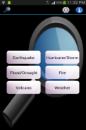
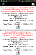
This app does not aim to replace the existing public domain websites that provide the most up-to-date earthquake,hurricane/storm,tsunami, volcano information daily. What it does is to consolidate summary information from all the various websites into a single app for easy monitoring. A view on map function is also provided so user can know the location of the event on Google Map. Tap the top right Setting icon to set your timezone and date display format if you don't like the default.
If you have other public domain websites information that you want to include in this app like e.g volcano information, please contact the author.
Credit to weather sources CDYNE,OpenWeatherMap,Webservicex,World Weather Online.
The application support English, Simplified Chinese, Traditional Chinese display.
</div> <div jsname="WJz9Hc" style="display:none">Bu uygulama, günlük en güncel güncel deprem, kasırga / fırtına, tsunami, volkan bilgi sağlamak, mevcut kamu malı web siteleri yerine bir amacı yoktur. Ne yapar kolay izlenmesi için tek bir app içine tüm çeşitli web sitelerinden özet bilgileri pekiştirmek için olduğunu. Kullanıcı, Google Haritada olayın yerini biliyor böylece harita fonksiyonu üzerinde bir görünüm de sağlanmaktadır. Eğer varsayılan sevmiyorum eğer dilimi ve tarih görüntüleme biçimini ayarlamak için sağ üst Ayar simgesine dokunun.
Eğer, örneğin volkan bilgileri gibi bu app eklemek istediğiniz diğer kamu malı web sitelerinin bilgi varsa, yazar başvurun.
Hava kaynaklardan CDYNE, OpenWeatherMap, Webservicex, Dünya Hava Durumu Online Kredi.
Uygulama desteği İngilizce, Basitleştirilmiş Çince, Geleneksel Çince ekran.</div> <div class="show-more-end">


